
Check the sea before you cast off.
Simoy Marine shows wind, gusts, waves, tides and typhoon tracks for any spot on the water, hour by hour for the next 16 days.
Free. No ads, no account.
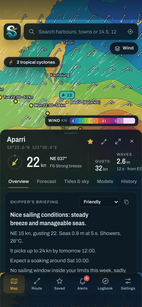
Everything you check before a day on the water, in one place
Tap any point on the map. Simoy Marine pulls the latest forecast for that exact spot and turns it into what matters on deck.
Wind, waves and weather for any spot
See wind speed and direction, gusts, wave height and period, swell and currents on one chart, then tap for the full picture: a plain-language briefing, air and sea temperature, rain, UV and air quality.
- Forecasts up to 16 days ahead
- Animated wind, wave, swell and current layers
- Knots, metres per second, Beaufort or km/h
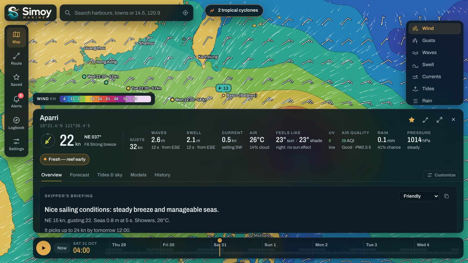
Follow typhoons and see what they mean for your harbours
Simoy Marine looks for tropical cyclones in the forecast models around the area you're viewing, draws their likely track and tells you how close each one comes to the places you've saved.
- Track, peak wind and timing for each storm
- Impact on each saved spot
- Always check official warnings too
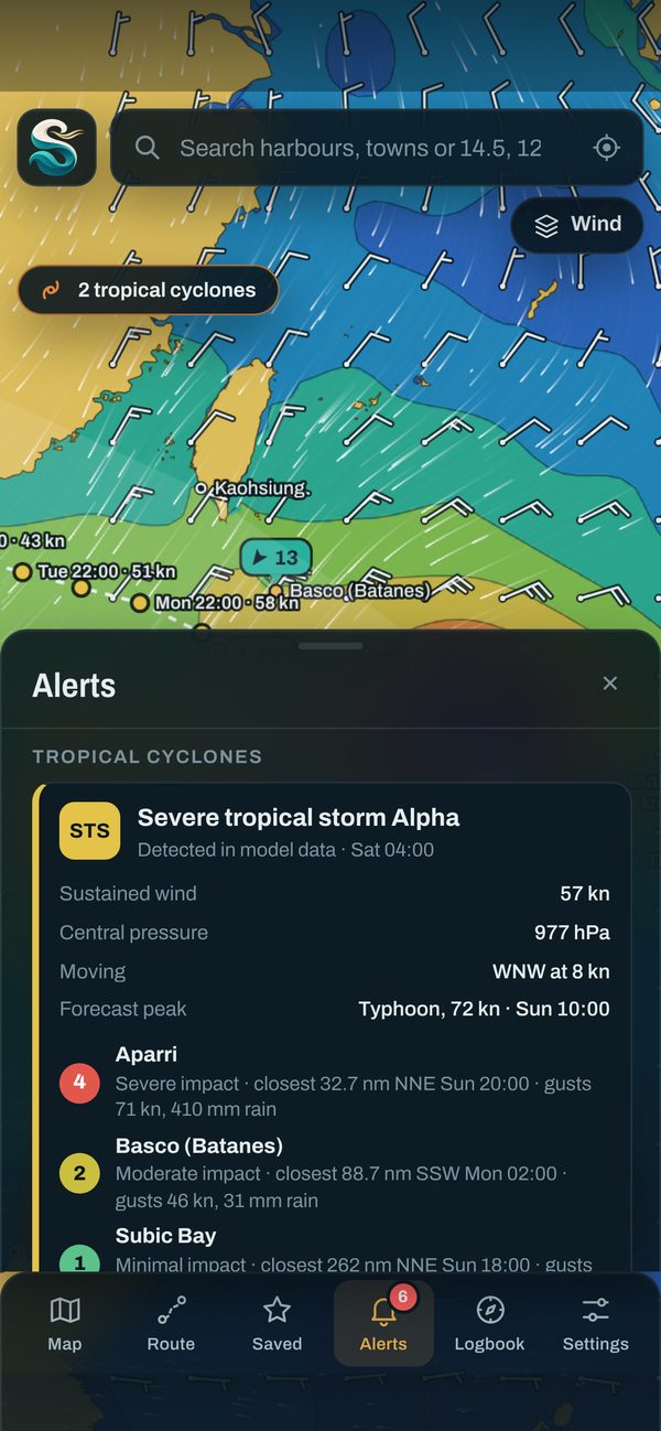
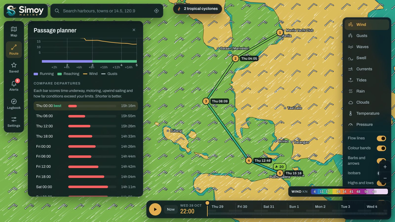
Plan a passage with arrival times and wind angles
Drop waypoints on the map. Simoy Marine works out when you'll reach each one, the wind you'll meet on the way and whether you'll be running, reaching or beating.
- Compares departure times to find the best one
- Warns when gusts or waves pass your limits
- Distance, time under way, fuel and arrival
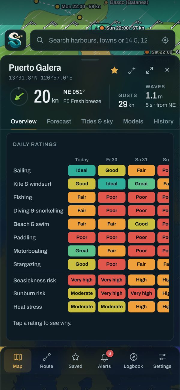
Know the best days to sail, fish or dive
Each day gets a simple rating for the things you do on the water, from sailing and kitesurfing to fishing, diving, paddling and stargazing. Tap a rating to see why.
- Ratings for eight activities
- Seasickness, sunburn and heat stress risk
- Set your own limits for wind and waves
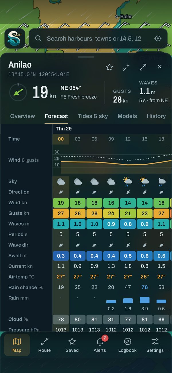
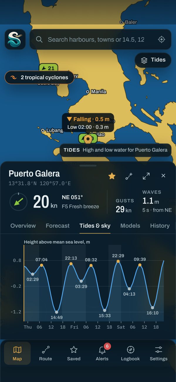
Hour by hour, tide by tide
Read the detail in a forecast table you can customise, with tide heights, sunrise, sunset and moon phase alongside. Compare weather models to see how sure the forecast is.
- Hourly or three-hourly steps
- High and low water times
- Several weather models side by side
Made for the water, not for your data
No account
Open it and go. Your saved spots, routes and settings stay on your device.
No ads or tracking
Simoy Marine has no advertising and no analytics. It's free, with nothing to buy.
Clear when offline
If Simoy Marine can't reach the weather service, it tells you, instead of showing an old forecast as if it were new.
Get Simoy Marine
The App Store and Google Play versions are on their way. You can use Simoy Marine in your browser today.
iPhone and iPad
iOS and iPadOS 15 or later.
Mac
Macs with Apple silicon run the App Store version. On any other Mac, use Simoy Marine in Safari or Chrome and add it to your Dock.
Android phones and tablets
Android 7.0 or later.
Any browser
Works on phones, tablets and computers. Install it from your browser's menu to open it like an app, even without a connection.
Questions
What does Simoy Marine mean?
It comes from simoy (say it see-MOY), the Filipino word for a breeze: the first thing you check before heading out on the water.
Where do the forecasts come from?
From Open-Meteo, which combines forecasts from national weather services, including ECMWF, NOAA GFS, DWD ICON, Environment Canada GEM and JMA, with marine models for waves, swell and currents. Simoy Marine shows several models side by side so you can see where they agree.
Which parts of the world does it cover?
All of it. Forecasts are available for any point on the map, and harbours and place names are built in worldwide.
Is it really free?
Yes. There are no ads, subscriptions or in-app purchases, and you don't need an account.
Can I use Simoy Marine for navigation?
No. Simoy Marine is a planning aid. Forecasts can be wrong, and storm tracks drawn from model data are not official warnings. Always check your national weather service, official storm bulletins and notices to mariners before you go.
Does it work without a connection?
The app opens without a connection, but forecasts need one. When Simoy Marine can't reach the weather service, it says so clearly.
What does Simoy Marine do with my location?
Only what you ask: if you tap My location, Simoy Marine uses it to fetch the forecast for where you are. Your position goes only to the weather service, rounded to about 100 metres, and is never used for tracking or advertising. The privacy policy has the details.
More questions? Visit help and support.